


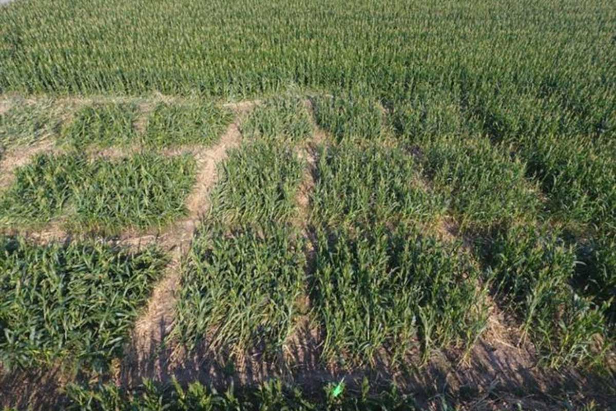
Researchers used unmanned aerial vehicle to conduct a survey of maize lodging experiments in Hebei Province. Credit: Qian Sun, Yangzhou University. CC BY.
Drones have been shown to provide an effective method in which to monitor maize re-growth, according to a new report.
Maize, or corn, grows tall, with thin stalks that boast ears of the cereal grain used in food production, trade and security globally.
However, due to rain, wind and other increasingly extreme weather events, the maize falls down, risking the entire crop.
Called ‘lodging’, the physical fall results in shorter plants and overlapping leaves — both of which negatively impact the plant’s ability to grow.
Conventional lodging prevention and mitigation requires many agricultural technicians significant time to investigate the crop fields, according to a team of researchers based in China.
They said that a potential solution could be a rapid, non-destructive method of remote monitoring, called Unmanned Aerial Vehicle (UAV)-based hyperspectral imaging.
The team recently found that the method can accurately evaluate maize recovery without the time or expense of individuals physically inspecting the crops.
First author Qian Sun, a doctor at Yangzhou University, said: “UAV-based hyperspectral imaging technology revolutionises the way we monitor and assess the recovery of lodging crops.
“This advanced method allows for rapid, non-destructive evaluation of plant health and growth.
“This not only aids in better understanding the state of plants but also enhances overall crop management practices, potentially leading to more effective interventions and improved agricultural production.”
Detailed understanding
UAV-based hyperspectral imaging involves using drone-like vehicles that can fly with limited human input and examine the field.
For every pixel in an image, the method determines the multiple spectral bands — a much more detailed understanding than human eyesight, which only sees across three bands of visible light.
The researchers used UAV-based hyperspectral imaging to assess canopy height and coverage, as well as physiological activity of maize, such as chlorophyll production — evidence of photosynthesis, an energy-producing process that may reduce if stalks are shorter or leaves are obscured by other plants after lodging.
This two-prong approach is necessary for accurate assessment, the researchers said, as measuring just one variable provides an incomplete picture of the maize’s regrowth progress.
Co-corresponding author Xiaohe Gu, a professor with the Research Center of Information Technology, Beijing Academy of Agriculture and Forestry Sciences, said: “This technique allows for more precise monitoring and assessment of lodging crop conditions compared to traditional methods.
“In particular, this study proposed a comprehensive evaluation framework that combines the canopy structure and the physiological activity, delivering a precise and efficient means of assessing the recovery grades of lodging maize.”
They determined that their imaging approach could accurately assess both the canopy stature and the physiological activity, providing information to farmers who could then make adjustments to the crops to assist in their recovery.
Co-author author Liping Chen, a professor with the Research Center of Information Technology, Beijing Academy of Agriculture and Forestry, added: “The ultimate goal is to revolutionise agricultural practices through the widespread adoption of UAV-based hyperspectral technology.
“By making this advanced tool a standard component in crop monitoring, we aim to significantly enhance the accuracy and efficiency of assessing plant health and recovery.
“This will enable farmers and agronomists to manage crops more effectively, optimise interventions, and ultimately increase yield and productivity.”
The research is published in the Journal of Remote Sensing.


